Photos of Basecamp Airfield
Taken by Glenn Campbell, Aug. 5, 1996

The Troll Guarding Basecamp
Basecamp Airfield is an auxiliary airstrip and support facilities adjacent to Route US-6 about 10 miles northeast of Warm Springs. This is a "secret" facility in plain sight: Signs on the fence say only the "U.S. Government" owns the facility, and personnel there will not divulge any further information. Circumstantial evidence indicates this facility is operated by a government contractor on behalf the Air Force Flight Test Center, probably in support of testing programs at Area 51. Basecamp is in line with the runway at Groom Lake, making it a possible emergency field for aborted take-offs of test aircraft from there.
See Basecamp page for more information on facility.
Below are photos of Basecamp Airfield and Halligan Mesa radar site north of Warm Springs on US-6 in Nevada. Also included are two photos of US-6 near the Tonopah Test Range. Copyright is asserted on all photos; they may not be copied or reproduced without permission.
Residential Compound
- Panorama of Residential Compound north of Tybo Road, from vicinity of US-6. (17k)
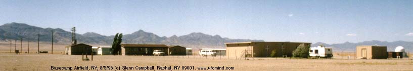
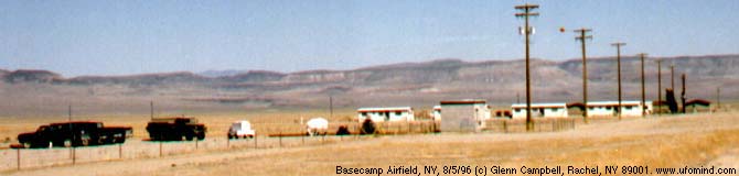
- Residential Compound seen from runway. Gazebo and radar/optical dome are seen at left; fire station and industrial compound are on right (14k)
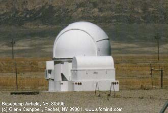
- Small radar or optical dome seen in residential compound. It is about 12 feet high.(12k)
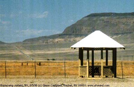
- Gazebo in the residential compound. US-6 approaches Sandy Summit in the distance. (23k)
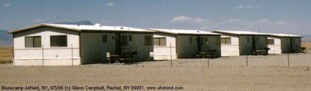
- Close-up of houses in residential compound. (17k)
Industrial Compound
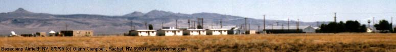
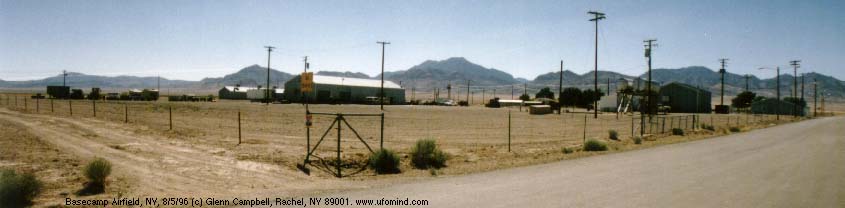
- Panorama of Industrial Compound south of Tybo Road. (25k)
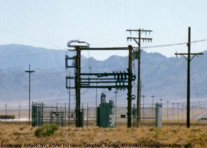
- Power substation serving Basecamp. Adjacent to the industrial compound.(17k)
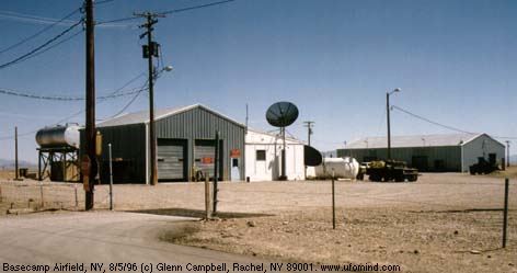
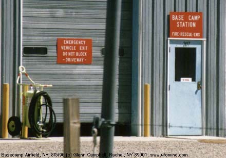
- Fire Station (19k)
- Close-up of signs posted on fire station. (26k)
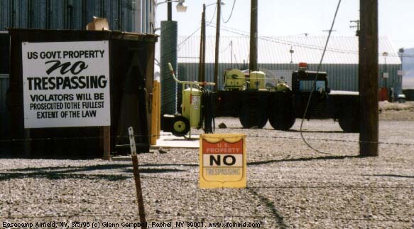
- No trespassing signs on fence beside fire station. (44k)
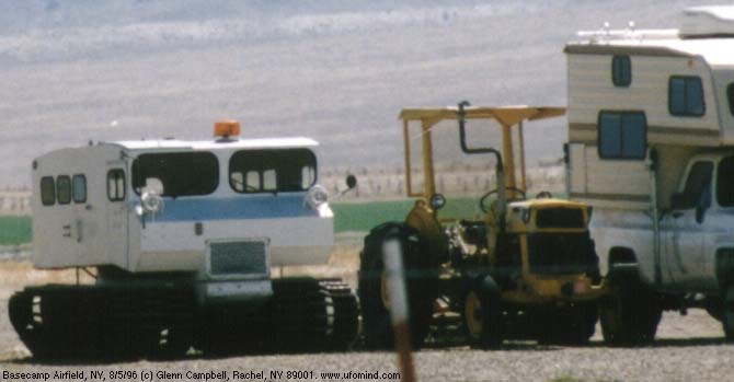
- A tracked vehicle seen in the industrial compound. A camper is shown to the right for size comparison.(26k)
The Runway
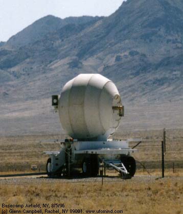
- VOR-TAC navigation beacon (I assume). Can anyone identify this exactly. (15k)
- Globe-like device, perhaps a radar, about 1/4 south of the airstrip, lines up with it. (21k)
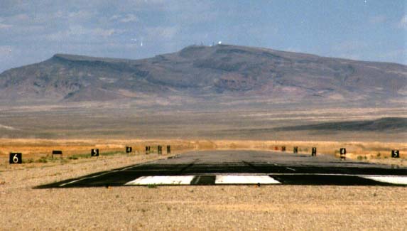
- Looking along the runway toward the north. Radar site on Halligan Mesa lines up perfectly. South end of runway: 38š18.937'N, 116š16.930'W. (26k)
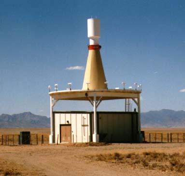
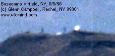
- Close-up of radar site on Halligan Mesa. ( 6k)
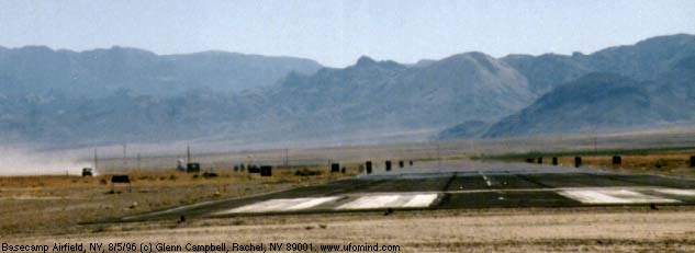
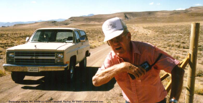
- Viewing south down the runway from the north end. Vehicle approaching is that of the troll, who following me as I made my survey but did not interfere until I approached Halligan Mesa. North end of runway: 38š19.989'N, 116š16.197'W. (19k)
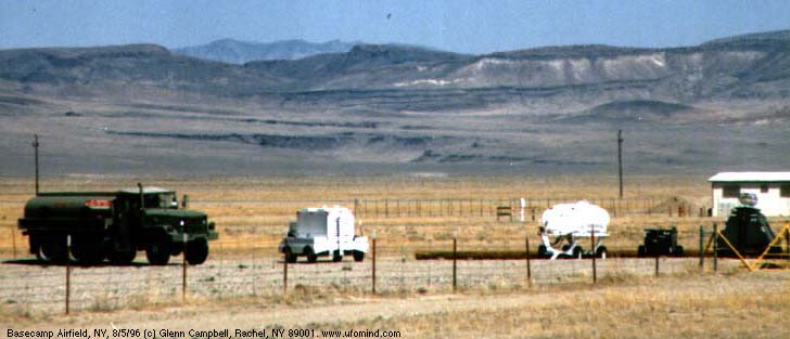
- Equipment at the small tarmac at south end of airstrip. (17k)
- Close-up of fuel truck and generators on tarmac. (35k)
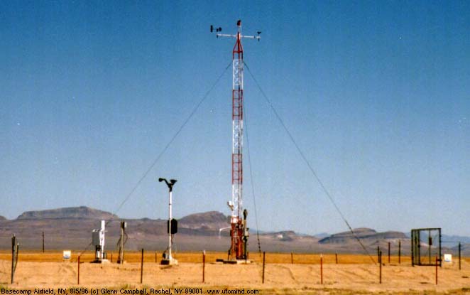
- Weather monitoring equipment near the runway. (27k)
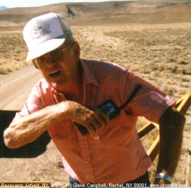
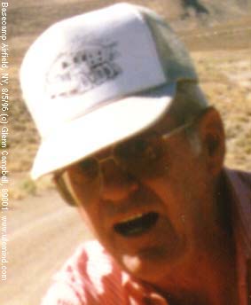
The Troll of Basecamp
Defends Invalid No Trespassing Signs
- Wide angle view of troll warning me to stay off road to Radar dome from US-6 near Sandy summit (Milepoint 73.7). Troll claims there was a U.S. Government No Trespassing sign on the post to his right. He says he put it there himself. (46k)
- A misplaced no trespassing sign about 1/4 mile from US-6 on the dirt road to Halligan Mesa. The BLM right of way (N-42984) grants no such exclusive government access, so the sign should not be here. GPS: 38š27.843'N, 116š08.690'W (61k)
- The troll alone, without surroundings. (24k)
- Close-up of of troll's face. (11k)
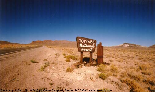
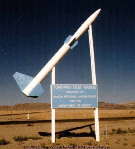
Along US-6
Traveling from Basecamp to Tonopah
- Warm Springs, the defunct stage stop at the junction of US-6 and Highway 375. GPS: 38š11.442'N, 116š22.138'W. (58k)
- Entering Toiyobe National Forest... But where's the forest? (22k)
- Sign for Tonopah Test Range on US-6 (Milepoint Nye 13.6). Paved road beside the sign, labelled Route AR-504" leads about 20 miles to the main gate of TTR. GPS: 38š04.755'N, 117š00.578'W. (23k)
Milepoint Notes: (No photos.)
- The old Tonopah Army Airfield, now the municipal airport for Tonopah, is located at Milepoint 8.8 on US-6.
- The unpaved road to the TTR main gate from the east leaves US-6 at Milepoint 38.7. The road is marked "Silver Bow/Golden Arrow." GPS: 38š08.944'N, 116š34.724'W.
Scanned & Assembled by Glenn Campbell
|
Reader Comments |
Regarding "Basecamp Airfield - Photos" - Latest First
|
|
I recieved an email regarding my last comment on this page. The dickhead who sent it asked me if I am a 20 year staff sergeant and if I am proud of washing out of GAC. To answere your questions: I have only been in 26 months and yes I am glad I washed out of GAC, I didn't want to work on airplanes. I now have an awesome job in networking. I am much happier here than I ever would have been working on planes.
|
|
|
On picture #12 you ask if anyone can identify this exactly. It sends signals out to an aircraft's guidance and control system so that they can use autopilot. The pilot types in the coordinates of the base into the GAC system and then autopilot finds the signal, locks on and follows it. I can't remember what it is called exactly. I know this because I'm in the Air Force and I washed out of an Aircraft Maintenance job.
|
|
|
Yes a Chevy Blazer
Well looking at the photo of the Troll. It is odd that he is dresssed in civilian clothing, but I beleive that is only so that he is not drawn any attention to himself. If you look closely in the passenger side there appears to be a man in full military uniform sitting there. He is wearing all green and a green cap. Something to think about...
|
|
|
Hmmmmmmmmmm......
ok so it may not be a Dodge Ram.. I've never seen a Chevy Blazer with a hood ornament and no the Chevy "bow tie" on the grill does not show on the picture I have access to. As far as being embarassed...hardly...at least I'm not standing in the hot sun in Las Vegas at EG&G counting cars and hoping I can count every passenger and crew that board a 737 that doesn't exist and supposedly goes to a place that equally shares non-existance.
-- Bobster
7/18/99 (#31)
|
|
View 30 Other Comments
Created: 8/9/96
Repairs: 4/20/97 gc