Book Catalog
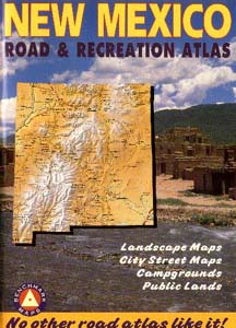
New Mexico Road & Recreation Atlas
 Our Price: $17.95
Our Item Code: nmatlas
Postage Code: book2
96 Pages, Trade Paperback
Cover Size: 11 x 15 inches
Benchmark Maps
Related listings: New Mexico
Date: 1995
Added to Catalog: 12/14/96
(Revised 12/96)
WIRT: 443431x4
Availability: This item is usually in stock and available for immediate
Priority Mail shipment. Order it today (by 8pm Eastern/5pm Pacific),
and you will probably have it in 2-3 days (in USA).
Features: Oversized, Table of Contents, Appendix
|
|
Our Review |
Opinion of the webmaster, subject to debate |
Credibility
4
High |
Research Value
4
High |
Cultural Interest
3
Moderate |
Visual Information
4
High |
Style
3
Functional |
Silliness
1
Very Low |
Wow Factor
NR
Not Rated |
Bargain
4
High |
|
Explanation of Ratings
|
|
Contains detailed road, relief and land-use maps for all
parts of the state, as well as detailed street maps of the
largest cities. Ideal for both travel and research. This
book actually includes two statewide atlases: One is a set
of shaded relief maps; the second is a set of maps in the
same scale showing land ownership. Street maps of
Alburquerque, Santa Fe, Las Cruces and Roswell are included,
along with street indexes for each. This atlas is the
equivalent of the Delorme series (which does not yet have a
New Mexico atlas), and in many ways it is superior.
-- Glenn Campbell
This catalog provides the sole financial support
for the Ufomind website
and our many free on-line services....
Your purchases keep us going!
If you find out about a book here, please order it here.
|
|
|
Information from the Publisher |
Always supportive |
The text below is taken from the back cover. Each title below is
linked to a sample map. (The relatively crude quality of the images
here does not reflect that of the atlas itself.)
The world isn't flat, so why use maps that look that way? Landscape Maps
show you not only the roads and towns, but also the mountains, arroyos
and mesaa that make New Mexico such a great place to explore.
Relief shading makes the land appear three-dimensional while coloring
shows altitude above sea level. Roads on the map don't just cross mountain
ranges - they wind through foothills, climb over passes and drop down
valleys
on the other side.
Find out who owns and manages the land you'd like to explore. State and
Federal forests and rangelands, parks, tribal lands, military bases and
wildlife refuges are all color coded for easy reference.
Over one third of New Mexico is managed by Federal agencies and another
fifth is under State or indian trobal control. Ten different types of
public or Indian lands are shown with a key on each page. You can see
both where you are and who owns or manages the land.
Complete, detailed street maps of Albuquerque, Las Cruces, Rio Rancho,
Roswell and Santa Fe compiled by exhaustive on-the-ground surveys in 1995.
Includes every street for these cities - from major highways down to dirt
roads. These maps show neighborhoods, parks, hospitals, shopping districts,
schools and other vital information. The most authoritative and easy-to-read
maps ever made of New Mexico's most important cities.
Indexes
In addition to street indexes for the largest cities, statewide indexes are
included in the back of the atlas for...
- Cities and Towns
- Counties and County Seats
- State Parks and Monuments
- National Forests, Parks and Monuments
- Indian Reservations
- Campgrounds
- Lakes and Reservoirs
- Mountain Ranges, Peaks and Other Physical Features
Also included:
- A 4-page table of recreation sites and their amenities.
- A national highways map
- A statewide road map
|
Indexing Information |
Other Relevant Ufomind Pages |
Related Pages & Products