
| Links | |
| Books |
|
|
The following is the topgraphical map of the area in question: The highlighted area is the area in which the sighting occurred. Note the power substation near the upper right corner, the pond (slightly below the right of the bottom edge) and the reported party location (near the left edge of the highlighted area.
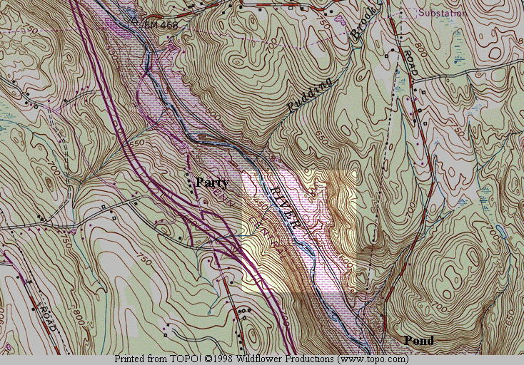
As you can see, the sighting location is in a river valley. The typical altitude of the ridges around the valley has a maximum at around 700 feet MSL (above sea level). The river valley is 450-500 feet MSL. The area is rugged, has low population, and is heavily forested with deciduous and conifers. The left side of the road is mostly deciduous, the right mostly coniferous. The highest local population density is in the area of the party, and that is where the primary canvassing was performed.
Two power line sets (the larger is to the south of the sighting area) converge on a substation to the NE of the sighting area.
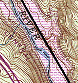
This map is a closeup of the sighting area and a marked copy showing the major features of the event:
 |
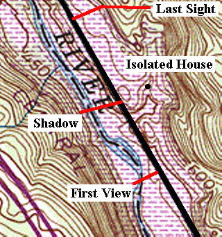 |
| The road crosses the map diagonally from SE to NW on the east bank of the river, elevated slightly above it. |
This map shows the location indicating the approximate position of the vehicle when the object was first seen, the most distant possible location of the closest edge of the shadow crossing, and the place where the object was last seen and was directly right of the vehicle. You can see that the ground stops rising at the shadow crossing point and enters a gentle downward slope. The isolated house to the right was canvassed as mentioned. Distances are as follows
|
This site is an archive of the content of the MUFON CT website from the late 1990s. The current MUFON CT organization should be contacted through the MUFON web site.